A Geologic Map of Ireland
previous post
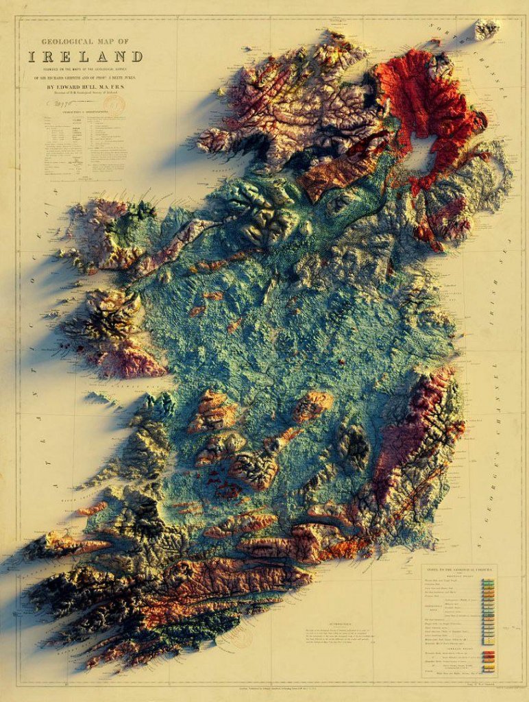
This is really cool! Found this on Reddit – it originated on Twitter. It’s a map of the geology of Ireland in three dimensions. Very cool to see to get context of the landscape of Ireland. It’s based on an old map from 1878.

Here’ the original tweet:
I had some requests for Ireland…so:
— Sean Conway (@geo_spatialist) May 7, 2020
Geological map of Ireland founded on the maps of the Geological Survey of Sir Richard Griffith and of Profr. J. Beete Jukes / by Edward Hull,M.A. F.R.S – 1878#arcgispro #blender #Ireland #Copernicus #maps #map #gis #geological pic.twitter.com/XNbGhcYYaD
Jonathan is the publisher of Irishtopia.net, Anglotopia.net, and Londontopia.net. He's passionate about travel and learning about other cultures. He's been to Ireland several times, and uses his travel expertise for Irishtopia!

The website for people who love Ireland – by Americans.
Copyright @2025 All Rights Reserved – Designed and Developed by Anglotopia, LLC